
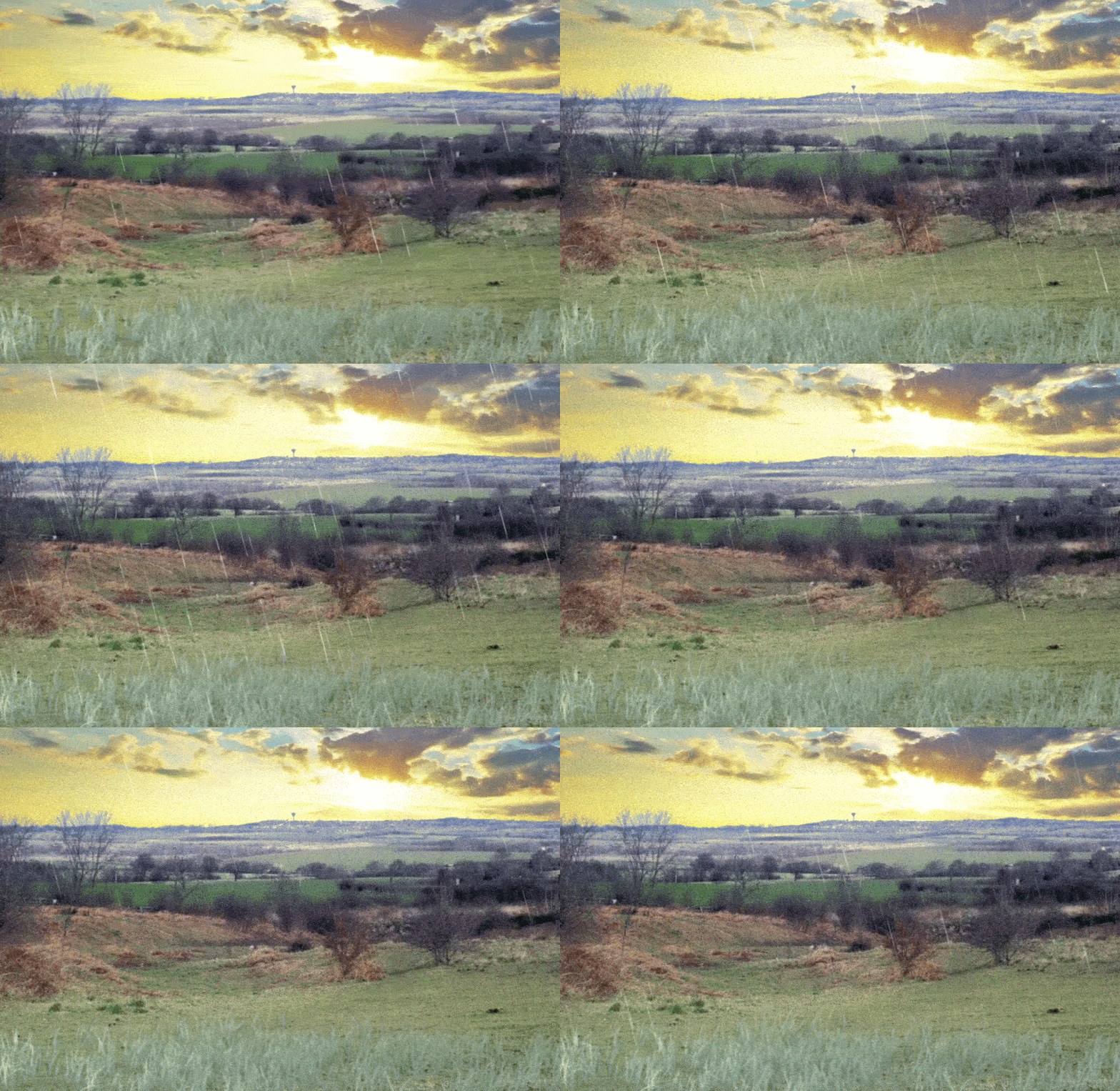
The earthworks off Holmsley Lane, a scheduled ancient monument variously known as the camp or hillfort, have undergone a remarkable transformation in both interpretation and public perception. Within living memory they have been attributed to several different periods of history, with local opinion shifting from an Anglo-Saxon origin to the hillfort’s modern identification as an Iron Age hillfort. The Anglo-Saxon theory particularly was so widely accepted, at one time, that it led to streets nearby being named after it, including Saxon Mount, Saxon Grove, Saxon Avenue and Camp Road. For ease of continuity the earthworks will be referred to from here as a ‘hillfort’.
W. S. Banks wrote the earliest known interpretation of the hillfort, in 1871, where he surmised that it was of Saxon origins, as a “site of a supposed Saxon camp, as it is called on the ordnance map” and this explains where the long held Saxon origin theory came from, though ultimately Banks admitted that “the history of it is not known.” This was the beginning of the rejection of the Saxon date attribution.
Local historian Aaron Wilkinson wrote a letter to the South Yorkshire Times and Mexborough & Swinton Times, which was published on the 11th of August 1962, reflecting on the recent discovery of the remains of a man buried close to the Roman road, in North Elmsall’s boundaries. These remains were found along with what was thought to be a bronze belt buckle, and a spearhead, by a worker digging a drainage ditch. The archaeologist who led the subsequent investigations into the find, Mr H. V. Bellamy of the University of Leeds, sent the spearhead away to the British Museum for evaluation, with the results being that it was attributed to the Anglo-Saxon period of the sixth or seventh century.
Aaron Wilkinson was adamant that the burial had not been rushed and was facilitated by a group of local hunters. He theorised that “There is an Anglo-Saxon camp nearby, at South Kirkby, less than two miles away. The hunters could have come from there.” In what seems to be a rather remarkable leap of faith Wilkinson then made an astonishing claim that: “…we know that after Penda, the pagan king of Mercia, had killed King Edwin, at the Battle of Hatfield, near Doncaster, in [the year] 633, his forces ravage a large part of Yorkshire and the dead man could well have been a victim of that battle.” The connection was entirely speculative and no supporting evidence was provided.
In his ‘A History of South Kirkby’ Aaron Wilkinson was less sure of himself. He wrote: “In the village of South Kirkby there is an ancient camp site which, if it is of Anglo-Saxon origin as has been suggested…” then: “If it is of the iron age period, as has also been suggested…” but by the very next paragraph Wilkison says: “We will assume, then, that the first people who lived here (South Kirkby) were of Iron Age origin and that they lived a peaceful life in their fortified enclosure.” That is something of a contradictory statement. Even more confusingly Wilkinson’s next paragraphs on this topic imagine, at some length, a hypothetical scenario where a unidentified Roman legion passed by South Kirkby, on the nearby Roman road, and stumbled on the hillfort. No evidence is cited in support of this scenario.
However, in 1967, the Anglo-Saxon theory was argued against by a South Kirkby resident, writing using a pen name, in local press, and it is rather intriguing. In a letter, published by the South Yorkshire Times and Mexborough & Swinton Times on the 24th of June 1967, the mysterious historian said that: “There seems to be no foundation for the popular notion that the earthworks at [South] Kirkby are Saxon. They are a part of Dunsley. Dun is a Celtic word meaning a fortified place and a relic of that language which seem to have been adopted by the Anglo-Saxon community when they found it convenient to give the place a name. Ley was a field or pasture…” The author was confident that the hillfort was “…as much an ancient earthwork to the Saxons as it is to us.” This mystery writer posited that by the time of the Domesday book the local memory of the town’s origin had been long forgotten. They said: “The name Kirkby shows a Danish or Nordic element was so dominant…” “…so long, it would appear, that the Saxon name was out of use, and the best entry the Norman scribe could make was Cherchebi.”
There is some truth here, in that the etymology of the Celtic/Brittonic word dun (in Welsh, din) is found throughout Great Britain in names associated with hills, forts and defended enclosures, such as Dundee, Dinas Powys and Edinburgh (from Din Eidyn). So it is a reasonable argument that if the area of the hillfort was called Dunsley before the Anglo-Saxons arrived, then the name may preserve a memory of an already ancient fortified place, with a name that may preserve a Brittonic or Celtic linguistic origin. Dunsley could preserve a genuinely ancient name, or it could be a much later medieval name that merely references a hill or earthwork. And indeed to this day the name the name also survives in the modern landscape through Dunsley Terrace, Dunsley Lane and other local references such as on Ordnance Survey maps, suggesting that it remained in local use long after the medieval period.
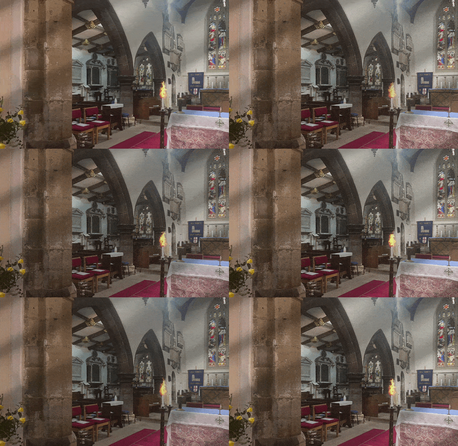
The letter writer, who believed that South Kirkby would have been likely to have been called Langthwaite, was convinced that the real Anglo-Saxon fortified area of the village would have been close to All Saints Church, in road junction known until fairly recently on Ordnance Survey maps as Cross Hill, with Stockingate and Lydgate being two gated entrances to this fortified area. Again, in etymological terms ‘thwaite’ is a Scandinavian settlement term that comes from Old Norse and usually means a clearing, a meadow, or, intriguingly, land cleared for settlement. This isn’t a bad theory, that the original settlement at South Kirkby was known as Langthwaite, it is perfectly reasonable. In fact one of the remaining stone cottages in Moorthorpe is still known as Langthwaite House, and to it’s south is Langthwaite Beck, Langthwaite Lane and so on. But there is simply no evidence provided to prove this theory, beyond speculation.
In a further letter, penned under the same pseudonym, published in the South Yorkshire Times and Mexborough & Swinton Times, on the 14th of August 1971, the name Stockingate was again discussed. The author theorised that the first part of Stockingate was: “Stoccen, indicating that part of a tree twixt base and branch, or a timber cut from it, hence that ancient instrument of chastisement, two parts of which were fastened about the legs.” In layman’s terms, stockings. They added: “…the name Stockingate and Lydgate tell us not only where these portals were but what was the nature of their construction…” This is again not a totally unfair assumption for the author to make. The Anglo-Saxons would indeed have used the term ‘gate’ to describe an entrance way, so roads with that suffix flanking an area could well indicate that it was at one time fortified.
The root stocc definitely exists in Old English and means post, log, tree stump or stake but when the mystery historian takes that and concludes the entrance was constructed of timber stockades they are moving beyond what the name alone proves. The name might indicate timber posts or a boundary or a gate built of wood but it cannot by itself demonstrate a fortification existed besides where All Saints Church stands. But a key take away from these anonymous letters is that by 1967 the long held consensus that the hillfort off Holmsley Lane was Anglo-Saxon was being challenged, with some reasonable ideas, and this was the beginning of a shift towards a common belief that it was much older, possibly Iron Age.
There is something else here that is interesting to consider. Some readers may question why, if there was an ancient fortified settlement on a prominent hilltop in South Kirkby, a later one was created in the valley close to the church. This is not all that uncommon and reflects a pattern recognised at many archaeological sites across Great Britain, where ancient monuments remained visible in the landscape while later communities established themselves elsewhere. Under this model, the earthworks at Holmsley Lane may have originated as a prehistoric enclosure, perhaps dating from the Iron Age, before falling out of use during the Roman period as settlement patterns changed. By the Anglo-Saxon era, centuries later, the old earthworks would already have been ancient features whose original builders were long forgotten. Instead, the focus of settlement and defence may have shifted to the area around present-day All Saints Church, known at the time of the letter’s publication as Cross Hill, where the writer believed place names such as Lydgate, also recorded as Lidgate, and Stockingate preserved memories of gateways into a defended enclosure.
Interestingly, Wilkinson touched upon some of the same place-name evidence in ‘A History of South Kirkby’, although he did not go so far as to propose a secondary fortified settlement around the church. Wilkinson agreed that thwaite was derived from Old Norse, while interpreting gate simply as a road leading into a settlement, and identified Lydgate and Stockingate as two such routes. He then developed his own theories regarding the origins of the local place names, suggesting that Lidgate derived from lythe, meaning a ledge, and that so-called “ledge gates” functioned as toll points. Wilkinson also interpreted Stockingate as a road passing through cleared land, while arguing that dun meant a place on a hillside and ley a meadow. Whether or not these interpretations are correct, it is notable that both Wilkinson and the anonymous correspondent sought to explain the landscape through its place names, albeit arriving at very different conclusions about the origins of South Kirkby and its ancient earthworks.
Similar patterns can be seen elsewhere in Britain, notably at Castle Hill, Almondbury, near Huddersfield, where a prominent Iron Age hillfort survived through the Roman, Anglo-Saxon and medieval periods while subsequent settlement developed around, rather than within, the ancient earthworks. The anonymous author’s argument was therefore not merely that the Holmsley Lane earthworks were older than the Saxons, but that they belonged to an entirely different phase of South Kirkby’s history, with later communities reusing the surrounding landscape while leaving the ancient enclosure as a prominent landmark.
Further evidence for prehistoric activity in the vicinity of the South Kirkby earthworks has emerged in recent years through aerial archaeology. The West Yorkshire Historic Environment Record (MWY742) contains a record for a probable banjo enclosure at Dunsley, approximately 700 metres from the hillfort. Identified from cropmarks, the enclosure is described as “lemon-shaped”, measuring roughly 40 by 40 metres, with a broad eastern entrance leading onto a north-south trackway. Associated features include further trackways, linear ditches and possible field boundaries spread across several hectares, suggesting the hillfort formed part of a much larger and more organised landscape than the surviving earthworks alone might imply. Rather than an isolated monument, the hillfort appears to sit within a wider archaeological complex of prehistoric activity. This includes a substantial double ditched enclosure almost 100 metres across (MWY743), a possible ring ditch with a central pit (MWY114), and numerous other enclosures, trackways and field systems visible as cropmarks in the surrounding fields.
Particularly revealing is the overall Historic Environment Record for the Dunsley cropmark complex (MWY748), which brings together this wider landscape of enclosures, trackways and field systems clustered around the South Kirkby earthworks. The record describes the complex as “unparalleled in West Yorkshire” and specifically notes that its relationship to the hillfort, only around 250 metres away, merits further investigation. In light of this evidence, the anonymous South Kirkby correspondent who wrote to the local press in 1967 appears to have a genuine grasp of the local landscape.
Although some of the author’s place name interpretations remain speculative, the broader suggestion that the earthworks pre-dated the Anglo-Saxon period is entirely consistent with the archaeological picture now emerging. The growing body of archaeological evidence from the Dunsley area of South Kirkby raises the possibility that the Holmsley Lane earthworks were not a solitary fortification but the focal point of a much larger prehistoric farming and settlement landscape, traces of which can still be detected beneath the modern fields surrounding South Kirkby.
Even more remarkable is the evidence that the history of this part of the South Kirkby landscape stretches back far beyond the Iron Age. Discoveries recorded in the West Yorkshire Historic Environment Record include Mesolithic microliths and blades (MWY13972), Neolithic scrapers and a Bronze Age barbed-and-tanged arrowhead (MWY3100), additional Mesolithic and Neolithic blades recovered from nearby fields (MWY13998), and a polished stone axe of Langdale Group VI stone discovered by local collector Granville Clayton in 1973 (MWY13507), all recovered from fields surrounding the earthworks in South Kirkby. One collection alone, gathered by Clayton during the 1970s, contained seventy-six worked flints spanning the Mesolithic, Neolithic and Bronze Age periods (MWY3100).
Other finds include waste flakes associated with the manufacture of stone tools (MWY3100; MWY14000), further Mesolithic microliths (MWY14000), and evidence of prehistoric activity extending across neighbouring parts of the local landscape. Collectively these discoveries suggest that this prominent ridge above South Kirkby was attracting human activity long before the construction of the earthworks and may have been repeatedly visited, occupied and exploited from at least the Mesolithic period onwards.
At first glance the record of human occupation around the South Kirkby hillfort appears to contain a noticeable gap during the Roman period. In truth, however, there is some emerging evidence that the surrounding landscape continued to be used during the Romano-British era. The West Yorkshire Historic Environment Record includes a substantial double ditched enclosure at Dunsley (MWY743) that has tentatively been attributed to the Roman period, while the wider Dunsley cropmark complex (MWY748) contains enclosures, trackways and field systems of uncertain date, some of which have been interpreted as Iron Age or Romano-British in origin. Nearby at Hemsworth, aerial photography has also revealed curvilinear and rectilinear enclosures that have similarly been interpreted as prehistoric or Romano-British features (MWY744).
Although definitive evidence for Roman settlement immediately around the hillfort remains limited, the available archaeological record suggests that the area did not simply fall silent after the Iron Age. Instead, the emerging picture is one of a long lived and evolving landscape that continued to be occupied, farmed and reorganised over many centuries. Rather than a sequence of entirely separate episodes, the evidence increasingly points towards continuity of activity, with successive communities adapting and reusing the same favourable ridge top landscape from prehistory through the Romano-British period and into the historic era, however, the nature and extent of this possible Romano-British activity remains poorly understood and would benefit from further investigation.
So, what archaeological work has actually been carried out at South Kirkby Camp? In truth, not an awful lot, and the details of this scarce work can be found in the West Yorkshire Historic Environment Record, MWY62. The next earliest known investigations appear to date to between 1895 and 1916, when Mr E. Andrew Downman recorded observations of the earthworks. The first known excavation did not follow until 1949, when officers including Mr F. Atkinson, from Wakefield Museum, assisted by pupils from a local school, cut a trench through the bank and ditch. Contemporary reports stated that the excavation uncovered animal bone, charcoal, pottery and evidence of a timber fence situated between the rampart and ditch.
The pottery finds were described as Iron Age, although a later Ordnance Survey archaeological investigation into this pottery suggested that the material may instead have been medieval. The basis for this reassessment is unclear from the records, but the staggering discrepancy serves as a reminder that some aspects of the site’s interpretation remain open to question. Despite this uncertainty the 1949 excavation remains the only intrusive investigation known to have produced artefacts directly associated with the monument itself.
A resistivity survey was undertaken in 1978, a further survey in 1987 sought evidence for a possible northern entrance, and an extensive geophysical survey in 1997 identified possible internal features, traces of what may have been an inner ditch, and a possible small enclosure within the earthworks. However, none of these investigations produced firmly datable artefacts, and a watching brief carried out during the construction of a car park built in 1997, to allow for the hillfort to be publicly accessible, revealed no archaeological features. On the evidence from the hillfort alone, therefore, the case for a definitive Iron Age date is less clear cut than some modern accounts imply. The argument becomes considerably stronger when the wider landscape is taken into account.
As a whole the masses of surrounding finds and landscape interpretation, of the fields surrounding the earthworks, suggests that the South Kirkby hillfort formed part of a long established prehistoric landscape. Though the exact date and original purpose of the enclosure may not yet be proven beyond doubt, its setting within a concentration of prehistoric and possible Romano-British archaeological features makes a prehistoric, and quite possibly Iron Age, origin the most convincing interpretation currently available.
Interest in making the hillfort something of a tourist attraction was on the agenda for Wakefield Council who at one time had an interest in the hillfort, and proposed their intentions to take action to secure it’s long term future. Their tentative plans were published in the South Yorkshire Times and Mexborough & Swinton Times, on the 11th of April 1980. “Steps are to be taken by Wakefield District Council to preserve the Iron Age hill fort off Holmsley Lane, South Kirkby.” They added: “The fort is a scheduled ancient monument which the county archaeologist has described as unique in West Yorkshire. The site adjoins council owned land, and the authority wants to safeguard its future by ensuring it is not developed for housing but is laid out for a public open space. The fort is a scheduled ancient monument which the county archaeologist has described as unique in West Yorkshire.”
This article estimated that the hillfort complex was approximately 8.4 acres and would cost £5,000 to tidy up, initially, with Wakefield Council aiming to secure further funding from “grant aid bodies, including the Countryside Commission, the Tourist Board, and the Urban Aid Programme. In 1997 South Kirkby & Moorthorpe Town Council picked up the baton, when they secured a National Lottery Heritage Fund Grant of £24,900, with the aim of instigating a three year improvement plan to make the hillfort a destination for locals and tourists, keen to discover more about the site’s history, along with the wider local heritage. In an article published in the South Yorkshire Times and Mexborough & Swinton Times of the 22nd of May, 1997, an overview of the hillfort was provided, though totally lacking in citations of where the information was gleaned.
Described as an iron age fort the earthworks was earmarked for rejuvenation that would ensure that “the fort will be a major attraction on the SESKU Environment Group’s 11 mile ringway footpath link…” and would make it “…one of the highlights of the Town Council’s historical gems.” The same article noted that: “the Town Council, through the hard work of Councillor Malcolm Evans, Chairman, Councillor Dennis Moore, Deputy Chairman, and members of the Recreation Committee, has sought to preserve what can of the history, with the Iron Age Fort, at one of the parish’s highest points, off Holmsley Lane, being a jewel.” Councillor Laurie Harrison, Leader of the Town Council, also was quoted, saying: “South Kirkby has a rich seam of history which we want to uncover and offer to local and tourists.” It was in this period of works that the now closed off car park was constructed.
Concern over the future of the hillfort has not been confined to archaeologists and historians. Proposals for the route of HS2 prompted fears that the railway could damage the monument or its wider setting. The issue attracted regional attention when I publicly raised concerns via the Wakefield Express about the impact of the scheme and described the monument as a key feature on the landscape which had survived centuries of change, including the dramatic industrial transformation brought about by coal mining. Local residents backed this campaign and argued that the site represented one of the few surviving links between the modern town and its prehistoric past. Among those who joined me in voicing concerns was Jon Trickett MP who described the hillfort as “a precious part of South Kirkby’s heritage”. Thankfully the eventual HS2 proposals did not result in the destruction many had feared, the episode demonstrated that South Kirkby Camp remains more than simply an archaeological monument. More than two thousand years after it may have first been constructed, it continues to provoke debate about how local heritage should be valued and protected.
As for the anonymous historian who penned those mysterious letters to the local newspapers, and who seemed surprisingly ahead of their time in interpreting the landscape around the hillfort, sadly no finds have yet emerged that shed any light on their theory that a secondary, later fortified site once existed near South Kirkby’s church. But never say never. As for their identity, in the spirit of the leaps of faith described earlier in this article, perhaps it was Aaron Wilkinson himself. Wilkinson certainly had a penchant for writing letters on matters of local history and archaeology, and it is conceivable that he may have been using the medium of the local press to explore ideas that he was not yet prepared to present as established fact. There is, however, no evidence for this whatsoever, and the author’s identity remains a mystery.
And the future of the hillfort itself remains unclear. Despite its archaeological importance South Kirkby Camp is currently listed on Historic England’s Heritage at Risk Register. The hillfort was last assessed as being in a “generally unsatisfactory” condition with “major localised problems”. Historic England considers the hillfort to be highly vulnerable, notes that its condition is declining, and currently assigns it Priority A status, meaning that no agreed conservation strategy is in place despite ongoing concerns. The designation is perhaps a reminder that, while debate continues over the precise date and function of the earthworks, the monument itself remains a rare and significant survival within a much wider prehistoric landscape. After decades of debate over its origins, perhaps the more pressing question today is not when it was built, but how it can be preserved for future generations.



What are your memories of this?